
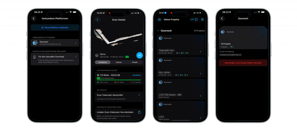
The scin® app is integrated into the following platforms:


Don’t see your platform listed yet? We’re continuously expanding our integration network.
Apply for Partner Access and bring your platform to the SCIN® ecosystem.
With geomesh you can process all drone data sets in addition to the scin® app data sets. Combine both acquisition technologies to be even more efficient. The easiest way to view, measure and inspect your 3D scans up to a report is the geomesh cloud.
Organize your projects and teams via 4 different user roles.
Simple measurement functions for single points, lines and surfaces, as well as volume calculations help you to create your measurements quickly and digitally. Summarize everything in a standardized report and link your condition survey for verification purposes.
geomesh cloud is available for all regions where scin is running. If you are already a customer of viDoc® and/or the scin® app, or have your own DJI Enterprise drone, then the path to using our platform is short and easy.
To provide you with the best possible experience, we use technologies such as cookies to store and/or access device information. If you consent to these technologies, we may process data such as your browsing behavior or unique identifiers on this website. If you do not provide or withdraw your consent, certain features and functions may be affected.